Greylock Glen Trails
Greylock Glen’s trail network includes multi-use trails designed to accommodate a wide variety of users with different skills and interests. Greylock Glen also serves as a gateway to the Mt. Greylock State Reservation trail system. All distances provided are one-way:
Bellows Link (0.12 miles) – Fairly steep, grassy double track that connects the Meadow Loop with trails above, Wolf Tree and Bellows South Trail.
Bellows South Trail (1.06 miles) – Rocky, moderately steep trail to Thunderbolt four corners, and to the Bellows North intersection.
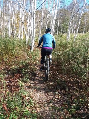
Birch Meadow Trail (0.55 miles) – Easy trail through a lovely birch meadow with views of Mt. Greylock, connects to Hidden Meadow and Moser Farm Loop.
Bittersweet Trail (0.55 miles) – Single track, somewhat flat across the meadow, then climbs in switchbacks to connect with Little Dragon Tail.
Brookside Trail (0.51 miles within Greylock Glen, 0.60 miles total) – Moderately steep, rocky climbs up to the first corner on the Cheshire Harbor.
Bucket Trail (0.47 miles) – Steep, through the meadow to start then woods path to White Tail or Thunderbolt.
Cheshire Harbor Trail (0.3 miles within Greylock Glen, 2.42 miles total) – Moderately rocky double track with switchbacks until about a mile, then take the right branch to climb to the summit.
Dave’s Pass East (0.35 miles) – Double track dirt pathway; smooth, steep, a really fun descent on a mountain bike. Meets with top of Moonwort.
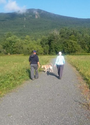
Glen Meadow Loop (1.57 miles) – Mostly flat, gravel covered 10-foot wide loop which meanders around the main part of the Glen.
Gould Trail (0.66 miles within Greylock Glen, 2.84 miles total) – Moderately steep and rocky in some places, good way to get to the summit of Mt. Greylock.
Gould Trail Connector (0.69 miles) – Single track, mostly flat with some incline, some rocky areas, pay attention to blazes to avoid unmarked trails.
Hidden Meadow Trail (0.39 miles) – Single track, mostly flat along a stone wall, then climbs slowly up a hill to connect to the Moser Farm Loop.
Little Dragon Tail (0.78 miles) – Single track, smooth and meandering, switchbacks through a beautiful hardwood forest to the “Dragon” and the “4 corners” of the Thunderbolt Trail.
Meadow Trail (0.11 miles) – Moderate, grassy path that connects Bellows South with Little Dragon Tail.
Moonwort (0.74 miles) – Single track, moderate switchbacks up, a nice hike through interesting wooded terrain with great views of the brook ravine. Also one of the best downhill runs on a mountain bike.
Moser Farm Loop East (1.25 miles) – Mostly flat double track, then climbs slightly to a beautiful view of Mt. Greylock and the Cheshire Harbor trail head.
Moser Farm Loop West (0.87 miles) – From the Cheshire Harbor trail head north a few small hills up then a long down great for skiing, biking or hiking.
Old Adams Road – Starts on Cheshire Harbor Trail, rises up to ridge and is moderately flat for much of it past the Cheshire Harbor Trail.
Peck’s Falls (0.07 miles) – Short, steep hike down to falls.
Ribbon Falls Trail (0.14 miles) – Steep uphill off of Moonwort, runs along the brook with water falls and comes out on Bellows South Trail.
Roost Trail (0.39 miles within Greylock Glen, 1.17 miles total) – Grassy, moderately easy path.
Snowmobile Trail (1.17 miles) – Winter use only for snowmobiles to go from one side of the Glen to the other.
South Side Connector (0.58 miles) – Single track designed for biking but also good for easy hiking; smooth, not technical with a short steep climb then moderately flat.
Thunderbolt Trail (0.83 miles within Greylock Glen, 1.80 miles total) – Very strenuous trail, starts out rocky double track then opens to a wide ski trail covered in ferns.
White Tail Trail (0.33 miles) – Moderate, grassy double track that connects Bucket Trail with Bellows South.
Wolf Tree Trail (1.09 miles) – Single track designed for biking but also good for easy hiking or running; smooth, not technical with an easy climb.
For a printable copy of the trail map, please click here.


